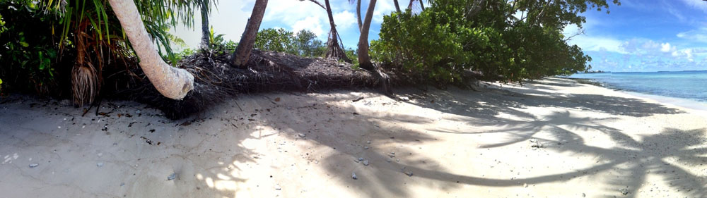
 For the first time in history the Tuvaluan people now have the capability to be able to make large-scale changes to their atolls and islands. With that capability comes a lot of potential for building resilience, but also the potential for serious damage. How it works out depends on the choices we make and how much information we have to support what we choose.
Big Changes in WWII
The capability to engineer change now, probably still does not rival the machinery and motivation shown by the Americans in World War II. The Americans came to Tuvalu on 2 October 1942, maintaining secrecy so that the Japanese did not learn of the occupation of Funafuti until March 1943. Nine times between 27 March and 17 November 1943 Japanese aircraft attacked Funafuti. Despite the bombing, little damage was done to human structures.
 What did change was the shape of shorelines, tree cover and lagoons caused by the American Navy Seebees in 1943 who carried out large engineering projects on the islands they occupied. This included:
- Building of runways on Funafuti, Nanumea and Nukufetau – in Nukufetau this resulted in the loss of nearly 50,000 coconut trees and about 2,000 feet of the runway was built on fill over swampland. In Funafuti, roughly half of Tafua (fully-enclosed mangrove) Lagoon was lost
- Creation of 10 borrow pits on Funafuti’s islets of Fogafale and Tegako to provide fill for the runway. The borrow pits rendered 8% of the land area in what is now the capital unuseable except as marginal land. Additional borrow pits were built in the shallow waters along the coast, disrupting sediment transport and possibly conveying sand out to deeper areas and away from the beach
- Cutting of a large boat passage through the reef platform into Nanumea’s ponding lagoon resulting in a 0.5m loss in water height at low tide. At least some of the erosion on Nanumea is likely to be linked to this
- Construction of a Catalina ramp on Funafuti, along with disruption of longshore transport of sands along the coast


Nanumea airstrip Built by US Seabees as a 7,000 ft crushed coral strip, shown September 1943
Engineering Now
These WWII interventions caused significant and mostly irreparable damage to the 3 atolls involved. Such changes, it is hoped, would not be agreed to by the government or development partners these days. The work was done in the blind, with precious little knowledge of how atolls work, or any of the background information we would use today.
There was a long period between WWII and now when development in Tuvalu was relatively small-scale in terms of atoll engineering. Effort was focused on the land for the most part and generally did not change the islands too much. Well, maybe… There were, through the years, many small seawall projects and channel construction to give better access for boats to all of the Tuvalu outer islands.

In the 1990’s a decidedly atoll-unfriendly harbour was built on Vaitupu that has caused quite a bit of erosion damage and greater risk to the village of wave-overwash. But it was not until 2011 that we saw the first large excavators working on the reef on many of the outer islands.
These days – post Cyclone Pam – there is talk of even bigger projects. Repairing or building seawalls and creating new harbours on the outer islands. These are happening at the same time as multi-million dollar projects for filling the borrow pits on Funafuti by dredging the lagoon, and redeveloping the runway and airport. The money and machinery available is great, but unprecedented. And as we noted previously here and here, there is scope for a LOT of damage if things are not done right.
In Atoll Engineering for Building Resilience we noted that 4 things or ideas are needed to develop the projects well. The most and fundamental of these is to undertake studies to gather the information we need for getting it right. Failure to get information to support and inform our development choices (including deciding not to do something because it would be too risky) is to work in the blind. For years that is exactly what people did – relying on experience they had gained in big countries where things are not the same !
What Studies and Information do we Need?
Talking to people at NIWA and SOPAC and others over the years, here are the kinds of studies we would need before atoll engineering involving beaches, reef platform, reef crest or lagoons goes ahead. Most of this information is of a strategic nature – we need to be collecting it on an on-going basis so that when projects come up, we can use what we have learned to make the best choices. That is, these should not attach to a particular project – they need to be programmed as part of ensuring the resilience of islands. Now do we need them all – getting long term data on one or more of these will go a long way to protecting our islands.
In Kosrae, for example, the Kosrae Shoreline Management Plan (Ramsay et al 2014) was developed to achieve sustained coastal development, planning, adaptation and mitigation. The key was recognising and accepting that engineered coastal defences were not a long-term solution to much of the coastal hazard issues that developed areas on Kosrae were currently facing. Rather, an approach was adopted that included elements that were a mix of:
- Ensuring the natural coastal defences are working as effectively as they can
- Greater emphasis on thinking about where to build infrastructure and housing away from areas at risk from coastal hazards
- An emphasis also on how to build buildings and infrastructure to account for the coastal hazards present, and
- Incorporating coastal protection only where there was absolutely no other option and ideally using approaches that would enhance the first three approaches. The aim was to work with coastal processes rather than trying to fight them.
While Kosrae is a ‘high island’ and at first glance very different from Funafuti, Nukufetau or any other island in Tuvalu, the same principle and approaches will be needed to sustainably adapt to the effects of coastal hazards and climate change on village development. We can learn a lot from the work already done there.
1. LiDAR High-resolution Topography (and Bathymetry)
We hear much about how vulnerable islands are to sea-level rise and inundation. This is true, but to respond to that we need to better understand, for example, which areas are potentially more exposed to inundation or change, how frequently these areas may be inundated now and how this may change in to the future. This needs both information on sea levels and how they will change AND land levels. Unfortunately good information on land levels, even on small atolls such as Tuvalu where all land is within a few metres of the sea, is generally very poor and very much limits our ability to provide improved information on how coastal inundation may affect different areas.
LiDAR (Light detection and Ranging) is a remote sensing technology that measures distance by illuminating a target with a laser and analyzing the reflected light to collect 3-dimensional point clouds of the Earth’s surface. This is the number 1 information now being called for for coastal management and particularly for disaster preparedness.
According to USGS this technology is being used for a wide range of applications including high-resolution topographic mapping, 3-D surface modelling, and infrastructure and biomass studies. 
This kind of information is needed for Funafuti as a priority, but also outer islands where island-changing developments are being planned. The land could be imaged, in addition to the reef flat and the reef slope. The information collected would provide a critical baseline dataset that would be of use for years to come, and for a variety of purposes. If there were a call for more sophisticated modelling, it would depend on a dataset such as this.
What can LiDAR tell us? According to Deep Reef working on the Great Barrier Reef, Australia, LiDAR can be used for:
- Natural hazard modelling of storm surge for coastal communities. This would require digital elevation models (DEMs) from the nearshore across the shoreline
- Modelling for sediment movements, water quality and plume tracking requires detailed topography to be used in the digital models
- High-resolution depth data allows for detailed studies to model the effects of sea-level rise, or changes in wave dynamics due to climate change.
Places that have collected LiDAR data, including other Pacific Islands have found it an invaluable baseline dataset that is now being used to support assessments and decision-making in a whole range of areas.
Ballpark cost: $1 million to do Tuvalu’s islands on land; $2 million to include bathymetry.
2. Modelling Coastal Processes
 Modelling can be used to analyse coastal hydrodynamic processes, including physical, numerical and composite approaches. Models are built and used to simulate the main phenomena in the coastal region being studied (Coastal Wiki) and to allow for predictions on what would happen if elements were changed (e.g. by development or during a disaster event). Physical models refer to the use of 3-D laboratory models at an appropriate scale (from small up to large scale models) for investigating the relevant process. Numerical models refer to the use of computer codes (commercial, open source, home-made software) and composite models (CM) refer to the integrated and balanced use of physical and numerical models. Hydrodynamic modelling forms the basis for many other modelling studies, whether sediment transport, morphology, waves, water quality and/or ecological changes are being investigated.
 Numerical models to look at sedimentary processes and impacts are expensive and may not be pragmatic for Tuvalu. Modelling is still fairly basic in terms of trying to understand short- and long-term sediment and beach movements, as well as the potential impacts of coastal construction. In the end, the modelling can use a lot of time and money to recreate a system so we can ‘see’ what happens if we do something to it (a development), but in the end comes back to applying expert judgement. In the northern hemisphere people may instead build scale physical models to investigate impacts on shoreline processes but this tends to be expensive.
Ballpark costs: Maybe $250,000 per island with a lagoon.
3. Wave Climate
Wave climate information is important because waves produce coastal impacts such as erosion, overtopping and inundation, and they can do so on a seasonal basis. In Tuvalu waves can come from ocean swell, especially on the eastern side of islands during the Easterly Season and they can come from wind and storms from the western side during the Westerly Season. The change in seasons results in periods of impact followed by periods of recovery for each side of an island.
On Niutao in Northern Tuvalu, a member of the Kapule (Island Council) told us “the island breaths. Sometime it takes little breaths, sometimes it takes big breaths”. He understood the pattern of annual change in beach movements due to the easterly and westerly wind and wave patterns around Niutao and how that varied from year to year.
 To manage impacts and design developments that work in with the changing seasons (and not disrupt or work against periods of recovery), we need to understand the characteristics and seasonal nature of waves – the wave climate – and the corresponding coastal and shoreline impacts. Knowing what kinds of waves we can expect, their frequency, and how this varies from season to season and year to year is central to understanding the natural workings of a coastline. This knowledge is critical to designing any kind of coastal structure to ensure it works with the natural coastal processes rather than against them and resulting in significant environmental impacts. Unfortunately it has to be said that many coastal engineering developments to date have been designed without this kind of information – and many have failed.
Figure: Hawai‘i dominant swell regimes after Moberly & Chamberlain (1964) and wave monitoring buoy locations (Vitousek & Fletcher, 2008).
Main technologies
Waves are measured using two main approaches:
Wave Buoys: Using an array of special wave buoys that can beam results home, NOAA monitors wave heights and directions. Over a period of time, this allows for the identification of very specific patterns, not only on a yearly basis, but also in relation to longer term climatic patterns.
Satellite: A second method for estimating wave heights comes from remote sensing using satellite imagery. It can give a very large scale picture across whole oceans. Figure: Satellite (JASON-1) derived average wave heights [m] over the North Pacific in the summer and winter.

However, computer models are typically used to derive the wave information that is required to understand both wave variability and hence shoreline change and to derive extreme wave conditions used for coastal engineering design. These computer models are compared with the measured wave conditions to ensure they are giving the correct results. Different types of wave models need to be used – to correctly create the wave conditions on the ocean side of each of the islands – wave conditions over the entire Pacific have to be modelled. In lagoon areas local wave models are used. Detailed wave modelling has been conducted in both Kiribati and the Cook Islands to develop the wave conditions (and how these may change with climate change) to support both island development planning and coastal engineering design.
Variability and Significant Waves
Inter-annual and decadal cycles including El Niño Southern Oscillation (ENSO) events (3-4 year cycle) and the Pacific Decadal Oscillation (PDO) (20-30 year cycle) can all influence the wave climate. These large-scale oceanic and atmospheric phenomena are thought to control the magnitude and frequency of extreme swell events and also affect cyclone conditions across the South pacific. For example, in Hawaii, strong ENSO events are thought to result in larger and more frequent swell events. Understanding the magnitude and frequency of extreme wave events is important as they may control processes such as coral development, beach morphology, and perhaps even more importantly the way that human structures interact with natural wave patterns in the balance between island building and breaking forces.
4. Measuring Tides, Sealevel & Currents
Knowing something about currents, tides and sealevel has to be high on the information-for-development list. Tuvalu has a tide gauge and consistent information is collected in Funafuti for tides and sealevel. An alternative approach to getting tidal data is by using satellite (altimetry) estimates, but these would not be anywhere near as accurate as using gauges. Lunar tidal cycles, astronomical tides (maximum and minimum for the year), in addition to atmospheric (low) pressure, winds, storms, ENSO & PDO cycles can produce significant water level variability. In Tuvalu such influences can mean that tides flood larger than ‘usual’ areas of the islands, and during cyclones storm surges can wash a long way inland. All of these kinds of tide/sealevel effects are important because they extend the actions of waves and currents further inland, including erosive forces, damage to infrastructure and property and damage to crops and water supplies. As this is in hand, go ahead and take a look at the monthly plot here.
 One thing we don’t know enough about is currents. Admittedly, this would not be as important as other types of information for all projects; but it has relevance to some. On a large ocean scale, there may not be too much need for information on currents for Tuvalu’s development projects – and this information is relatively easy to get using satellite data.
On a medium and fine scale things are different. For example, if we build an atoll sewage system and need to dispose of effluent out to the ocean side of Funafuti’s main islet (Fogafale), we need to know something about how currents may dilute and distribute the waste to ensure it does not just wash back on to land. However, this can be done relatively easily with short-term monitoring of currents using equipment that can be deployed at any proposed location for a long sea outfall.
Small longshore currents created by waves and wind are an important local-scale distribution system for sand. Understanding what makes these and where they go at different times of the year might make a huge difference to how we design ramps, jetties, harbours and channels. Finally, knowing how water moves within lagoons under the influence of tides, winds and other factors can inform us on matters of pollution, fisheries and other issues.
5. Historical Imagery – Island and Beach Changes
 Knowing how islands and beaches have changed over a longer time period is critical to development planning. Apart from the obvious information that states islands continually move, it can give us information on rates of erosion or accretion. Using photographs and satellite images, superimposed on each other, Webb & Kench 2010 showed not only how islets in Funafuti shifted around on their reef platform, but also that during a period of sealevel rise of 2 mm/yr 86% of islands stayed the same size or increased in area and just 14% showed a reduction in island size. This kind of analysis could tell us a lot about stable areas of islands and identify those not reliable for any kind of development infrastructure because they are constantly changing.
Ballpark costs: $30,000 to $50,000 / island.
Sources
Damlamian, H. 2008. Hydrodynamic Model of Funafuti:
Water Circulation and Applications. SOPAC Technical Report 133, 25pp.
Deep Reef : http://www.deepreef.org/projects/45-satellite-bathy.html
Kiribati KAP: http://www.climate.gov.ki/kiribati-adaptation-program/
Nanumea airfield WWII photos: http://wikimapia.org/15042825/Nanumea-WWII-airstrip-remains and https://en.wikipedia.org/wiki/Nanumea_Airfield “Nanumea Airfield 1943” by U.S. Navy – U.S. Navy National Museum of Naval Aviation photo No. 1996.253.7384.030. Licensed under Public Domain via Wikimedia Commons
PACC Cook Islands: http://www.undp-alm.org/resources/videos/pacc-cook-islands-vital-harbour
Ramsay, D., Webb, A., Abraham, S., Jackson, R., and Charley, B. 2014. Kosrae Shoreline Management Plan: Repositioning for Resilience. New Zealand National Institute of Water & Atmospheric Research Ltd. NIWA Client Report No: HAM2013-133, 94pp.
SOEST: http://www.soest.hawaii.edu/coasts/nps/waveClimate.php
USGS Light Detection and Ranging (LIDAR) : https://lta.cr.usgs.gov/LIDAR
Webb, A. and Kench, P. 2010 The dynamic response of reef islands to sea-level rise: Evidence from multi-decadal analysis
of island change in the Central Pacific. Global and Planetary Change.