 Up until recently, Funafuti, Tuvalu’s capital, had 33 small islets located around its atoll rim. One was removed in 1997. This year Cyclone Pam completely removed another islet and severely battered several others. Life for Funafuti’s islets seems pretty tough.
In 1992, McLean & Hosking recorded 33 islets spread around Funafuti’s atoll rim. The figure shows most of the islets, and the list shows their total area in hectares (ha) at that time. The total for the whole atoll was 2.70 square km, or about 668 acres.
The first islet to be lost in recent history was Tepukavilivili which was tiny at 300 sq m and appears to have been damaged during Cyclone Meli in 1979 (records are not good). The islet was located on the western atoll rim near one of the passages into the lagoon. By the mid-1990’s the islet had a dozen or so coconut trees (none of which was more than 20-30 years old) and consisted of a swirl of rubble and sand which is probably what gave it part of its name: in Tuvaluan ‘vilivili’ means twist. Some of the old people on Funafuti said at that time that the islet comes and goes. Then the islet disappeared during Cyclone Keli in 1997, with all of its vegetation and most of its sand washed away. Prophetically there was a Cyclone Pam in that year.
 In March this year another islet went missing. The missing islet was called ‘Vasafua’ and was located on the western side of the atoll, directly opposite a plume of sand seen exiting the lagoon on 15th March during the cyclone and reported in an earlier post. Vasafua was also small, but at 2,700 sq m, was nine times the size of Tepukavilivili.
There was other damage too. The Funafuti Kaupule (Island Council) carried out surveys of all the islets straight after Cyclone Pam had moved on. On Fogafale (the capital) there was damage along most of the western coast in the form of lost trees, wave over-topping and deposition of rubble onto the land and road, damage to buildings and water tanks and erosion of the already-compromised (by developments) western margin of the islet (beach ridge).
According to the Kaupule (Hosea 2015), at least the islets of Fualifeke, Tepuka, Fualopa, Fuakea (sometimes also called Fuagea) and Tefala were damaged by the cyclone. These islets are not settled by humans, so there were no structures affected. The main impacts were loss of land area and trees, severe undercutting of the beaches and exposure of underlying beach rock.
The losses of human structures on Fogafale were recorded by the Funafuti Kaupule assessment team, but unfortunately there are no quantitative measurements of how extensive the changes to the natural environment on all of the islets might have been.


")
 Figure: Islets clockwise from the North (ha): Mulitefala 1.74 | Amatuku 5.86 | Tengako 19.39 | Fongafale 142.16 | Fatato 4.75 | Funagogo 9.92 | Funamanu 3.44 | Falefatu 3.71 | Mateiko 4.43 | Luamotu 1.54 | Mafola 0.01 | Funafala 19.44 | Tefota 0.16 | Telele 7.54 | Motusanapa 0.51 | Motuloa 4.16 | Nukusavalivali 0.5 | Motungie 0.14 | Avalau 4.61 | Teafoafou 6.34 | Tengasu 0.64 | Tutanga 1.54 | Falaoingo 1.22 | Tefala 0.68 | Fuagea/Fuakea 1.64 | Vasafua 0.27 | Fuafatu 3.26 | Fualopa 2.16 | Tepukavilivili 0.03 | Tepuka 10.41 | Te Afualiku 0.28 | Paava 1.35 | Fualifeke 6.64 | Total 270.47 ha. Stars are the lost islets. Yellow plume of sand leaving the atoll observed on 15th March 2015.
Context
The islets of Tuvalu have been shifting and changing ever since they developed. Studying regions of the Pacific in which sea-level has been rising at the rate of about 2 mm per year, Webb & Kench (2010) found that in Funafuti, most of the islets either remained stable in size or grew larger over the past few decades (see also Kench 2014, Warne 2015).
 They say that “this suggests that coral islands are very dynamic landforms that adjust their shape and position on reef surfaces over decades. Low-lying islands are built by the action of waves and currents, which deposit sand and gravel at the shoreline. Just like any beach, as wave and current processes change, island sand and shingle is mobilised and deposited elsewhere on the shoreline. Through this ongoing process islands can change their shape and migrate across reef surfaces”.
This means that atoll islets / islands are not stable structures and cyclones can strip them of beaches, vegetation and soil, in the process changing their shape. Physical adjustments of the entire island shoreline as erosion may also be balanced by the growth of other parts of the islet’s shorelines (Webb & Kench 2010). Further, islands can grow upwards when waves wash over them during storms or tsunamis, depositing sand in the process – a process I call top-dressing. The top-dressing of an island may be important in filling up parts of the island as they naturally compact down.
Conclusions
Island growth, change, movement and recovery is a result of the combined forces of normal winds, waves and currents, the short-term but often large impacts of storms, and the actions of the people living on them. There are some signs that Tepukavilivili may have partially recovered after an earlier storm in 1979 before it was wiped out in 1997. Time will tell whether Vasafua, or for that matter Tepukavilivili will return to Funafuti in the long run, whether we have lost them for good, or whether new islands may form elsewhere.
References:
Hosea, P. 2015. Hazard and Risk Report for Cyclone Pam, March 2015. Report of the Funafuti Kaupule, 8pp.
Kench, P. 2014 “Dynamic atolls give hope that Pacific Islands can defy sea rise”. The Conversation. Retrieved 16 April 2014.
McLean, R. F. and Hosking, P. L. 1992. Tuvalu Land Resources Survey: Funafuti. FAO-AG-TUV/80/001, Island Report 7, 64pp.
Warne, K. (13 February 2015). “Will Pacific Island Nations Disappear as Seas Rise? Maybe Not – Reef islands can grow and change shape as sediments shift, studies show”. National Geographic. Retrieved 14 February 2015.
Webb, A.P. & Kench, P.S. 2010. “The dynamic response of reef islands to sea-level rise: Evidence from multi-decadal analysis of island change in the Central Pacific”. Global and Planetary Change 72 (3): 234–246. doi:10.1016/j.gloplacha.2010.05.003.
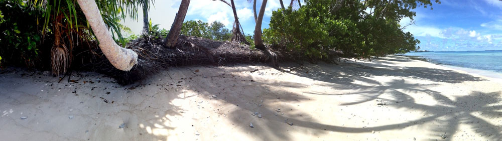
Islet photos taken by Funafuti Kaupule (Island Council)